| [ Login ]/[ Register ] |
 Search ::
  My Data Basket ::
  Favorite/My Favorite :: Recent Changes :: :: Login Save in Data Basket ]
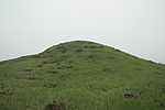
| Caption:周坝06号烽火台 Photo Time:2007-07-23 10:58:18 Photo Contributor:河北省文物局 [Open in New Window] |
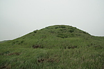
| Caption:周坝06号烽火台 Photo Time:2007-07-23 10:59:02 Photo Contributor:河北省文物局 [Open in New Window] |
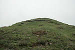
| Caption:周坝06号烽火台 Photo Time:2007-07-23 10:59:32 Photo Contributor:河北省文物局 [Open in New Window] |
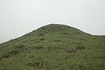
| Caption:周坝06号烽火台 Photo Time:2007-07-23 11:00:01 Photo Contributor:河北省文物局 [Open in New Window] |