Official Name:
赤山大口子壕堑ChiShanDaKouZiHaoQianOur Name:
/
Other Name:
/
Period:明
/ Ming Dynasty 1368~1644
Location: 甘肃省,张掖市,山丹县,起点:清泉镇北滩村东北约9千米处赤山大口子西侧止点:清泉镇北滩村东北约7千米处赤山牛沟口东侧 / GanSuSheng,ZhangYeShi,ShanDanXian,QiDianQingQuanZhenBeiTanCunDongBeiYue9QianMiChuChiShanDaKouZiXiCeZhiDianQingQuanZhenBeiTanCunDongBeiYue7QianMiChuChiShanNiuGouKouDongCe
[
Looking Local List]
Details:长城类别:界壕壕堑
起点经纬高度:东经:° ′ 北纬:° ′ 海拔:
终点经纬高度:东经:° ′ 北纬:° ′ 海拔:
墙体走向:
墙体类别:壕堑
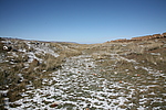
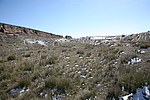
结构特点及构筑方式:壕沟上宽6米-8米,底宽2米-3米,深1.20米-2米,壕垄消失,据其保存现状和特点,共分为三个自然段。
第一自然段,起自第Z0453点,止于第Z0454点,长65米,由东北-西南方向延伸。壕沟上宽6米-8米,底宽2米-3米,残深1.20米-2米。保存差。
第二自然段,起自第Z0454点,止于第Z0455点,长1.4千米,因赤山大口子山洪冲刷淤积破坏,壕堑消失。
第三自然段,起自第Z0455点,止于第Z0456点,长625米,由东南-西北方向延伸,壕沟上宽6米-8米,底宽2米-3米,深1.20米-2米。段壕堑壕垄不存,壕沟被淤土填平,走向较清晰,保存差。
与相邻壕堑及周边长城墙体、单体建筑、关堡等的位置关系:该段壕堑东与明代土窑子壕堑相接,西北与明代牛沟口壕堑1段相连。
现状:
Type:
Protection Level:
Content:
Memo:
Other Records:
Distribution:
visit location in Tianditu Map[recommend] Distribution:
visit location in Tencent QQ Map Distribution:
visit location in Google MapDistribution:
visit location in Baidu MapNational ID:620725382202170001
The original number submitted by the local government :620725382202170060
(when the Great Wall is identified, the data whose code has been adjusted will display the original number submitted by the local government before revision, which can be used by the local cultural relics department when checking the local data.)
Action:[
 Save in Data Basket
 ]
Picture:
Click the thumbnail to view the Big Pic. Click the Big Pic to Hide the Big Pic![Caption:赤山大口子壕堑
loading images --Please wait...]()
![Caption:赤山大口子壕堑
loading images --Please wait...]() Photo Links
Photo Links:
 Search ::
  My Data Basket ::
  Favorite/My Favorite :: Recent Changes :: :: Login
 Save in Data Basket ]
