Official Name:
石梯子湖险ShiTiZiHuXianOur Name:
/
Other Name:
/
Period:汉
/ Han Dynasty 206 B.C.~316A.D.
Location: 甘肃省,酒泉市,金塔县,起点:大庄子乡双新村西北5.6千米处止点:古城乡下东沟村西北5.26千米处 / GanSuSheng,JiuQuanShi,JinTaXian,QiDianDaZhuangZiXiangShuangXinCunXiBei56QianMiChuZhiDianGuChengXiangXiaDongGouCunXiBei526QianMiChu
[
Looking Local List]
Details:长城类别:墙体
起点经纬高度:东经:099° 00′ 北纬:40° 16′ 海拔:1199
终点经纬高度:东经:098° 54′ 北纬:40° 16′ 海拔:1219
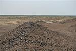
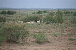
墙体走向:该湖险位于金塔县大庄子乡双新村西北的石梯子湖北岸,总体走向由东向西。
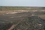
墙体类别及构筑方式:该湖险为自然湖泊水域。
墙体类别:河险
结构特点及构筑方式:无。天然湖岸形成屏障。
该湖险起点(第0320点)处为石梯子湖自然湖岸,止点(第0324点)处为北大河石梯子湖自然湖岸,全长10723.50米。
现状:
Type:河险 Precipitous river
Protection Level:
Content:
Memo:
Other Records:
Distribution:
visit location in Tianditu Map[recommend] Distribution:
visit location in Tencent QQ Map Distribution:
visit location in Google MapDistribution:
visit location in Baidu MapNational ID:620921382107040018
Action:[
 Save in Data Basket
 ]
Picture:
Click the thumbnail to view the Big Pic. Click the Big Pic to Hide the Big Pic![Caption:石梯子湖险
loading images --Please wait...]()
![Caption:石梯子湖险
loading images --Please wait...]()
![Caption:石梯子湖险
loading images --Please wait...]()
![Caption:石梯子湖险
loading images --Please wait...]() Photo Links
Photo Links:
 Search ::
  Favorite/My Favorite :: Recent Changes :: :: Login